Courmayeur · Val Veny · Chécrouit · Monte Bianco · Klaus Polzer · Guy Fattal · Lorenzo Rieg · Freeride photography
ExposureWhen the Mountain Disappears: Flat Light in Val Veny, and the Treeline That Saves the Frame
The commonest condition in the Alps and the least written about — cloud reduces the sky to one azimuthally uniform source, the shading gradient that described the slope stops existing, and what a camera has left to hold is a tree.
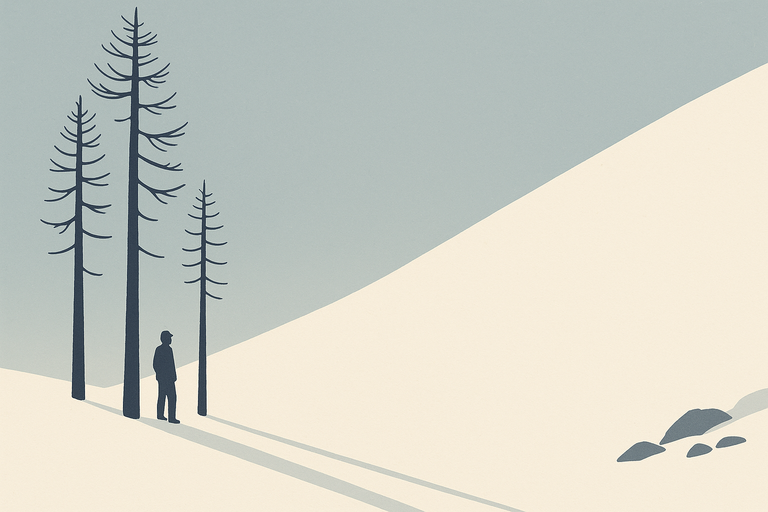
Ski-photography advice is written for a blue day, and the blue day is the exception. The Alpine winter delivers, far more often, a sky of uniform grey over a valley of uniform white, and in that condition the usual advice inverts: exposure is easy and the picture is impossible. Nothing is clipping, nothing is blocked, the histogram is a neat hill in the middle, and the photograph is of nothing at all — no slope, no rollover, no horizon, no sense of whether the rider is two metres off the snow or twenty metres down the hill.
That is not a failure of skill or of equipment. It is what happens when the illumination loses its direction, and in Courmayeur the one available answer is not a technique at all. It is a fact about the ground.
The sky becomes one lamp
Daylight engineering already has the model. The joint standard ISO 15469 / CIE S 011, Spatial distribution of daylight — CIE standard general sky, published by the Commission Internationale de l'Éclairage, sets out a family of sky luminance distributions running, in the CIE's own summary, "from the heavily overcast sky to cloudless weather", each expressing the luminance of any point in the sky as a function of the zenith luminance. In the tabulation given by Stanislav Darula and Richard Kittler of the Slovak Academy of Sciences in their 2002 eSim paper on the general sky standard, sky type 1 is the CIE Standard Overcast Sky, described in a phrase that decides everything a photographer sees: "steep luminance gradation towards zenith, azimuthal uniformity."
Azimuthal uniformity is the whole story. Darula and Kittler trace the overcast formula to Parry Moon and Domina Eberle Spencer in 1942, who described a horizon-to-zenith luminance ratio of 1:3 — the sky is roughly three times brighter overhead than at the skyline. That is a gradient, but it is a vertical one. Turn on the spot under a heavily overcast sky and the luminance in front of a person does not change. The sun's azimuth has dropped out of the equation entirely.
A slope is described by its aspect, the compass direction it faces, and under a clear sky aspect decides how much light a surface receives; the difference between one facet and the next is the shading gradient. Under an azimuthally uniform sky, aspect stops mattering, and a convex roll and the flat below it receive much the same illumination. There is nothing to record because there is nothing there.
Snow gives back everything
The second half of the mechanism is the ground. The US National Snow and Ice Data Center states that snow's albedo "is very high, reflecting 80 to 90 percent of the incoming sunlight". A surface that returns four-fifths of what it is given, under a source that arrives from every direction equally, is a surface with almost no tonal structure left. It is also a surface that sends most of that light back up into the cloud base to be scattered down again, until the sky and the snow converge on much the same luminance and the line between them stops being visible.
The condition has a name in aviation because it kills aircraft. The US Federal Aviation Administration's Aeronautical Information Manual, at paragraph 7-6-14, defines flat light as "an optical illusion, also known as 'sector or partial white out'" in which pilots "lose their depth-of-field and contrast in vision", and describes white out as the state in which a person "becomes engulfed in a uniformly white glow" where "there are no shadows, no horizon or clouds and all depth-of-field and orientation are lost". Photographers reach for the word loosely. The FAA does not.
What the shading was doing
The reason a photograph collapses is that the human visual system was reading the shading, and reading it in a particular way. V. S. Ramachandran, writing in Nature in 1988, showed that shape is derived from image intensity variations alone, and that the process is a global one which assumes a single light source illuminating the whole scene, conventionally from above. Take away the intensity variations and the machinery has no input. The eye is not being fooled by flat light; it is being starved.
The meteorological definition of visibility makes the same point from the other end. The World Meteorological Organization's Guide to Meteorological Instruments and Methods of Observation (WMO-No. 8) defines meteorological visibility by day as "the greatest distance at which a black object of suitable dimensions (located on the ground) can be seen and recognized when observed against the horizon sky during daylight", with the whole apparatus resting on what the guide calls the contrast threshold — "the minimum value of the luminance contrast that the human eye can detect". The definition presupposes two things: a black object, and a horizon to see it against. Flat light over snow removes both. A visibility figure and a photograph are, at bottom, the same measurement.
Nothing left to correlate
The autofocus module fails for a reason that is not analogous but identical. Canon's own list of shooting conditions that make focusing difficult opens with "Subjects with low contrast, such as a blue sky or flat surfaces in solid colors, or other cases when highlight or shadow details are clipped". Nikon's Z 9 reference guide, under its cautions on autofocus, states that the camera may be unable to focus if "the subject lacks contrast". Phase detection works by comparing two views of the scene formed through opposite halves of the aperture and measuring how far apart they lie; the measurement requires a luminance edge to correlate. A featureless white field supplies none, at any aperture, at any focal length.
Canon's clause about clipped highlights is the sharpest part of that list for anyone working on snow, because it names an own goal. The instinct in flat light is to raise exposure until the snow reads white. Every stop of that lift pushes the small remaining tonal separation closer to the top of the scale, where it is compressed and then discarded. The exposure decision and the focus failure are the same decision. What is left to focus on is the rider's clothing, a rock, or a tree — which is also, as it turns out, what is left to photograph.
A hazard before a picture
Reduced visibility is a safety problem first, and the institutions that say so are worth naming precisely. AINEVA — the Associazione Interregionale Neve e Valanghe, based in Trento — sets out the five standard avalanche problems in its guide Il bollettino valanghe e la scala di pericolo, and its entry on wind-transported snow says two things that matter on exactly this kind of day: that wind slab, where it is not buried under new snow, can be recognised with experience and in good visibility conditions, and that the problem is more common above the treeline. Put AINEVA's two statements together and a day that closes the top of a mountain with wind is a day that has, on AINEVA's account, been loading wind slab above the treeline while removing the good visibility AINEVA says the recognition depends on.
The forecast itself is regional and institutional. The daily snow and avalanche bulletin covering the Monte Bianco massif is issued by the Regione Autonoma Valle d'Aosta through its Dipartimento protezione civile, Centro funzionale e pianificazione. Fondazione Montagna Sicura — the non-profit foundation based at Villa Cameron in Courmayeur itself — carries that bulletin alongside its glacier monitoring, its outdoor environmental data platform and its webcams on Punta Walker, Punta Whymper and Punta Helbronner, which show whether the mountain is in cloud before anyone commits to it.
Two days in March 2015
The seventh edition of Click on the Mountain ran from 3 to 7 March 2015, with the shooting days set by the published schedule as Wednesday 4, Thursday 5 and Friday 6 March. Two of those three days are on the record here, and the thing that matters about them is that they are not the same day.
The Wednesday is the flat-light case. The contest's own archived 2015 news page records the seventh edition opening in adverse weather, with the resort under cloud and the first day's shooting held inside the Courmayeur Mont Blanc Funivie ski area, in fog. Writing on 8 March 2015 under the byline teddy, the German site skiing.de describes the same Wednesday as cloud-covered, and then says of the day after it that the Thursday turned out sunny — but stormy. Four teams were shooting: Klaus Polzer's, Guy Fattal's, Lorenzo Rieg's, and the team built around the photography partnership credited on the event's pages as Hiishii. At the start of the competition, skiing.de records, the teams split between freestyle spots in the woods and untracked powder up at Cresta d'Arp; the same report notes that Fattal's team lost a rider to injury and that Fattal destroyed one of his cameras in a fall. Polzer's book won the edition.
The Thursday was a different failure with the same destination. skiing.de reports that on that day strong wind forced the participants to stay below the treeline, because the upper part of the area had to be closed on account of the storm; the same report quotes Polzer to the effect that such things happen repeatedly and are simply in the nature of outdoor sport, and records that on the Friday the teams each had thirty minutes of flight time with Courmayeur Heliski. The contest's own archived page is more specific about where they went, placing the alternative spots among the woods of Val Veny; skiing.de says only that they were below the treeline. Both are given here rather than merged.
So the two halves of this piece sat on consecutive days rather than on one. The light went on the Wednesday. The woods took the teams in on the Thursday, and on the published record they took them in for wind, not for light. The only source here that describes the Thursday sky at all is skiing.de, and it calls that day sunny; the contest's own page for the day gives the wind and the lift closure and says nothing about cloud. No source located here gives a wind speed for it, and Courmayeur Mont Blanc Funivie publishes live lift status but no numerical wind-closure threshold that this desk has been able to find; the record on that point is silent.
What the larch woods supply
Being pushed off the top of the Courmayeur ski area is a specific descent, and the operator's own figures show what it lands in. Courmayeur Mont Blanc Funivie's published mountain statistics give the maximum lift altitude as Cresta Arp at 2,755 m and the maximum piste altitude as Cresta Youla at 2,624 m, with Plan Chécrouit at 1,704 m, Dolonne at 1,210 m and Courmayeur itself at 1,224 m; the same sheet lists the Arp–Val Veny off-piste itinerary as 1,230 m of vertical ending at Zerotta, at 1,525 m, and Youla–Zerotta as 1,099 m. The Regione Autonoma Valle d'Aosta's tourism database records the Val Veny cableway running from Entrèves to Pré de Pascal at 1,912 m.
The two ends of that descent are the whole point. Above, a lift top at 2,755 m and a piste top at 2,624 m. Below, the Val Veny flank between Pré de Pascal at 1,912 m and Zerotta at 1,525 m, and there the destination site published by Courmayeur Mont Blanc Turismo — operating as C.S.C. – Centro Servizi Courmayeur, and itself one of the contest's organising bodies from 2012 — has the sector's runs threading through larch woods and names the Peuterey forest. Where exactly the trees give out between those two bands is not stated by any source consulted here, and this desk will not put a number on it. What the record does state is where the woods are, and it is at the bottom. Larch is deciduous — EUFORGEN, the European forest genetic resources programme, describes Larix decidua as a deciduous conifer native to the mountains of central Europe — so in March the woods are bare, dark and vertical against snow.
That is the whole of the answer, and it is worth being blunt that it is a fact about Courmayeur rather than a portable technique. Flat light removes the shading gradient and the horizon; a stand of larch restores three things at once. It supplies the black object the WMO's own definition of visibility is built around. It supplies the vertical line that gives a slope angle something to be measured against, and a rank of trunks receding uphill is a distance ladder the snow cannot provide. And it supplies the luminance edge that both the eye and a phase-detection module need in order to work at all. The tone that survives the day is the tree.
Something here wrong or incomplete? Corrections are published, dated and kept: /corrections/.